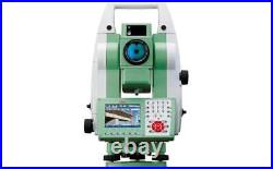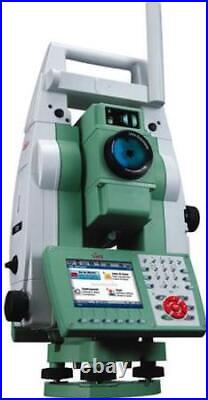


Michigan based company with a global presence. Offering New & Refurbished Total Stations, GPS / GNSS Base & Rovers, Radios, Antennas, Data Collectors, Grade & Pipe Lasers, Digital Levels, Magnetic Locators, Grade Control Systems, AgGPS Systems, Field Supplies, Accessories, Hand Tools & Safety Equipment! Leica TS15 P 3 R400 Robotic Imaging Total Station [ID- -L/T] Battery Pack Carrying Case. Leica TS15 P 3 R400 Robotic Imaging Total Station. Leica TS15 Robotic Imaging Total Station. Optimize your productivity with exact photo documentation of site conditions. With live streaming of the total station view, you always know what the total station sees. Measure all points without returning to the total station. Image Notes – Capture an image, screenshot or template, sketch on it and link it to any object in the database. Image Assisted Surveying – Simply tap on the display and the total station will turn and measure the desired target. TS15 uses years of experience to optimally combine the world’s best total station sensors: angles, distances, drives and the patented PowerSearch target recognition camera. Search – the unique PowerSearch fi nds your prism within seconds. Lock – stays locked onto your prism in the most demanding environments. Measure – PinPoint EDM seamlessly harmonizes with precise angle sensors to complete the measurement process. Add full GNSS functionality to your TS15 whenever you want and combine TPS and GNSS in the most efficient way. Use SmartStation for TPS setup without the need of control points, traverses and resections. Use SmartPole to save time with setup’On-the-fl y’ and measure parallel with TPS and GNSS for double productivity. 0.1” (0.1 mgon). 1.5” (0.5 mgon). Reflective tape (60 mm x 60 mm). 250 m (800 ft). Accuracy / Measurement Time. 1 mm + 1.5 ppm / typ. 3 mm + 1.5 ppm / typ. Distance Measurement (Any Surface). 400 m (1310 ft). 2 mm + 2 ppm / typ. >10000 m (>32800 ft). Long-range: 5 mm + 2 ppm / typ. System analyzer based on phase shift measurement (coaxial, visible red laser). Laser dot size (Non-Prism). At 30 m: 7 mm x 10 mm, at 50 m: 8 mm x 20 mm. Operating system & Processor. Windows CE 6.0. MX31 533 MHz ARM Core. 1° 30′ (1.66 gon) / 2.7 m at 100 m. 1.7 m to infinity. 640 x 480 pixel (VGA) color TFT with LED backlight and touch screen. 36 keys (12 function keys, 12 alphanumeric keys), illumination. Face I standard / face II optional. Memory, Ports & Communication. Internal memory / Memory devices. 1 GB (nonvolatile NAND Flash) / SD card, USB stick. RS232, Bluetooth® Wireless-Technology, USB mini AB OTG. Sensitivity of Circular level. 6′ / 2 mm. Centering accuracy of Laser plummet. 1.5 mm at 1.5 m. 1 horizontal / 1 vertical. 5 – 8 h (GEB221). 7.4 V / 4.4 Ah. Weight of Total Station. 4.9 – 5.5 kg / 0.2 kg / 0.8 kg. Height / Width / Length. 345 mm / 226 mm / 203 mm. Working / Storage temperature range. 20° C to +50° C / -40° C to +70° C. Dust / water (IEC 60529) / Humidity. IP55 / 95%, non-condensing. (Certain orders may take longer for processing due to comprehensive final service inspections). Sell Smarter with Kyozou. Inventory and Ecommerce Management. This item is in the category “Business & Industrial\Test, Measurement & Inspection\Levels & Surveying Equipment\Total Stations & Accessories”. The seller is “gps_land_survey_and_mapping_equipment” and is located in this country: US. This item can be shipped worldwide.
- Brand: Leica
- MPN: TS15
- Model: TS15 P R400


