Archives for : tcrp
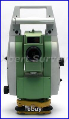
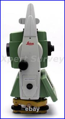
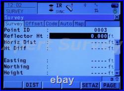
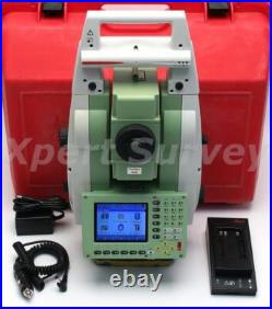
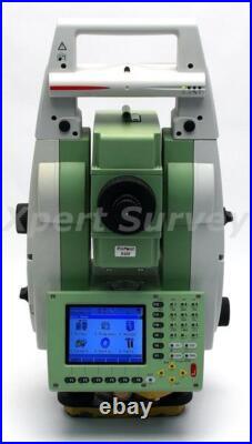
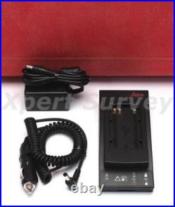
Entreprise basée au Michigan avec une présence mondiale. Nous expédions dans le monde entier à des milliers de clients satisfaits. Offre une expédition et un ramassage le jour même pour les arpenteurs-géomètres de la région métropolitaine de Détroit, les ingénieurs civils, les architectes, les entreprises d’excavation et de construction dans notre magasin local à Allen Park, MI. Notre équipement est soutenu par un service client et un support exceptionnels, ainsi que par une garantie complète. Offrant des stations totales neuves et remises à neuf, des bases et rover GPS / GNSS, des radios, des antennes, des collecteurs de données, des lasers de nivellement et de canalisations, des niveaux numériques, des localisateurs magnétiques, des systèmes de contrôle de nivellement, des systèmes AgGPS, des fournitures de terrain, des accessoires, des outils à main et des équipements de sécurité! Description de l’article. Station totale motorisée à cible automatique Leica TCRP1205+R400 5 ID- X3386-L/T. Calibré en usine Chargeur de batterie Leica GKL211 Pack de batterie Adaptateur secteur/chargeur Chargeur de voiture CC Manuel d’utilisation sur CD Étui de transport rigide. État : Remis à neuf. Garantie : échange de 90 jours. Station totale motorisée à cible automatique Leica TCRP1205+R400 5 – Calibré par un centre de service Leica. Tableau des spécifications du Leica TRCP1205+R400. Station totale motorisée à cible automatique Leica TRCP1205+R400 5. Superbe technologie de mesure. Mesures d’angles élevés, mesures précises et exactes à longue distance, prises en charge pour un système rapide et parfait, visée automatique au prisme. Vous travaillerez plus vite, plus rigoureusement et sous moins de pression. Interface intuitive, routines de base de données puissantes et programmes chargés dans la station totale : simplicité et identique en TPS et GPS. Visualisation facile de l’ensemble de la zone étudiée et accès immédiat à toutes les données mesurées. Vous voyez exactement ce que vous avez fait et ce qu’il vous reste à faire. Configurez et programmez le TPS1200 comme vous le souhaitez, pour ses applications, et exportez les informations nécessaires. Les stations totales TPS1200 couvrent une gamme de modèles et d’options. Sélectionnez ceux qui vous conviennent le mieux. Utilisez le TPS1200 pour tout. Utilisez les stations totales TPS1200 pour l’arpentage, l’ingénierie, l’implantation, la topographie, la surveillance, etc. Bénéficiez de l’énorme productivité du Système 1200. Trouver le prisme automatiquement. PowerSearch trouve les réflecteurs en quelques secondes, peu importe où ils se trouvent. Avec PowerSearch activé, le TPS1200 tourne et envoie un ventilateur laser vertical. Dès que le ventilateur heurte un prisme, le TPS1200 cesse de tourner, l’ATR prend le relais et peaufine le tout, de manière entièrement automatique. Précision (écart type ISO 17123-3). 5 (1,5 mg). Afficher le plus petit nombre. 0,1 (0,5 mggon). Plage de travail : 4′ (0,07 gon) Précision du réglage : 1,5 (0,5 mgon) Méthode : compensateur centralisé à deux axes. Mesure de distance (IR) (légère brume, visibilité d’environ 20 km ; ou ensoleillement modéré, léger reflet thermique). 3 000 m (10 000 pieds). 3 prismes standards (GPR1). 4 500 m (14 700 pieds). 1 500 m (5 000 pieds). Mini prisme 360° (GRZ101). 800 m (2 600 pi). 1 200 m (4 000 pieds). Bande réfléchissante (60 mm x 60 mm). 250 m (800 pi). Distance de mesure la plus courte. Précision (écart type ISO 17123-4) / Temps de mesure. Mode standard : 2 mm + 2 ppm / typ. 1,5 s Mode rapide : 5 mm + 2 ppm / typ. 0,8 s Mode de suivi : 5 mm + 2 ppm / typ. Principe : Mesure de phase Type : Laser infrarouge coaxial Onde porteuse : 780 nm Système de mesure : base d’un système de fréquence spécial 100 MHz = 1,5 m. Mesure de distance sans réflecteur PinPoint (RL) (objet à l’ombre ou ciel couvert). 400 m / 200 m (Carte grise Kodak : 90 % réfléchissant / 18 % / 18 % réfléchissant). Distance mesurable la plus courte/la plus longue : 1,5 m/1 000 m-7 500 m. Précision / Temps de mesure (écart type, ISO 17123-4) (objet à l’ombre, ciel couvert). 500m : 4mm + 2ppm / typ. 12s Longue portée : 5 mm + 2 ppm / typ. 2,5 s, maximum. Taille du point laser. À 30 m : environ 7 mm x 10 mm À 50 m : environ 8 mm x 20 mm. PinPoint R400 : analyseur de système (laser rouge visible et coaxial). Reconnaissance automatique de cible (ATR). Portée ATR / Mode verrouillage. Prisme standard (GPR1) : 1 000 m (3 300 pi) / 800 m (2 600 pi) Prisme 360° (GRZ4) : 600 m (2 000 pi) / 500 m (1 600 pi) Mini prisme 360° (GRZ101) : 350 m (1 150 pi) / 300 m (1 000 pi) Mini prisme (GMP101) : 500 m (1 600 pi) / 400 m (1 300 pi) Bande réfléchissante (60 mm x 60 mm) : 55 m (175ft) / – Distance de mesure la plus courte : 1,5 m / 5 m. Précision / Temps de mesure. Précision de positionnement (GPR1). Vitesse maximale (mode LOCK). Tangentiel (mode standard) : 5 m/s à 20 m, 25 m/s à 100 m Radial (mode suivi) : 5 m/s. Temps de recherche dans le champ de vision : Typ. 3 s Champ de vision : 1° 30′ (1,66 gon) windows de recherche paramétrables : Oui. Principe : Traitement numérique des images Type : laser infrarouge. Prisme standard (GPR1) : 200 m (650 pi) Prisme 360° (GRZ4) : 200 m (650 ft) (parfaitement aligné sur l’instrument) Mini prisme (GMP101) : 100 m (330 pi) Distance de mesure la plus courte : 1,5 m. Temps de recherche : Typ. Principe : Traitement numérique du signal Type : laser infrarouge. Lumière de guidage (EGL). Portée de travail : 5 m – 150 m. Précision de positionnement : 5 cm à 100 m. Grossissement : 30x Ouverture d’objectif libre : 40 mm Champ de vision : 1°30′ (1,66 gon) / 2,7 m à 100 m Plage de mise au point : 1,7 m à l’infini. Affichage : ¼ VGA (320240 pixels), LCD graphique, éclairage, écran tactile (en option) Clavier : 34 touches (12 touches de fonction, 12 touches alphanumériques), éclairage Affichage de l’angle : 360°’ , 360° décimal, 400 gon, 6400 mil, V% Affichage de la distance : mètre, int. Pieds/pouces, pieds américains, pieds américains/pouces Position : face I standard / face II en option. Mémoire interne : 32 Mo (en option) Carte mémoire : cartes CompactFlash (32 Mo et 256 Mo) Nombre d’enregistrements de données : 1750 / Mo Interface : RS232, BluetoothTM (en option). Précision de centrage : 1,5 mm à 1,5 m (écart par rapport au fil à plomb) Diamètre du point laser : 2,5 mm à 1,5 m. Des trajets sans fin. Nombre d’entraînements : 1 horizontal / 1 vertical. Sensibilité : 6′ / 2 mm. Type : Lithium-Ion Tension : 7,4 V Capacité : 3,8 Ah Durée de fonctionnement : Typ. 6 – 8 heures. Hauteur de l’axe d’inclinaison : 196 mm au dessus de l’embase Hauteur : 345 mm Largeur : 226 mm Longueur : 203 mm. Station totale : 4,8 – 5,5 kg (selon le type et les options) Batterie (GEB221) : 0,2 kg Embase (GDF121) : 0,8 kg. Plage de température de fonctionnement : -20°C à +50°C Plage de température de stockage : -40°C à +70°C Poussière / eau (IEC 60529) : IP54 Humidité : 95 %, sans condensation. Nous tenterons d’expédier votre/vos article(s) dans les 24 heures suivant la réception du paiement. Sur les articles expédiés depuis un pays étranger. Nous ne couvrons pas ces frais et nous vous recommandons de contacter l’agence douanière de votre pays pour obtenir ces informations. Le processus de paiement est conçu de manière à communiquer avec le commerçant pour confirmer que le paiement a été effectué et compensé. D’autres méthodes de paiement sont décrites via le processus de paiement en ligne. Les enchérisseurs gagnants doivent nous contacter dans les 3 jours suivant la clôture de l’enchère si des modalités de paiement spéciales sont nécessaires. Votre paiement est attendu dans les 5 jours suivant la clôture de l’enchère. Les enchères impayées seront annulées après 5 jours de clôture de l’enchère et les articles seront remis en vente. Les articles seront expédiés dans les 24 heures (1 jour ouvrable) suivant la réception du paiement de l’enchérisseur gagnant. (Certaines commandes peuvent prendre plus de temps à traiter en raison d’inspections finales complètes du service). Un ou plusieurs numéros de suivi d’expédition seront fournis pour informer les acheteurs de leur heure d’arrivée estimée (ETA). Les numéros de suivi seront fournis le jour même de l’expédition de la commande. Vendez plus intelligemment avec Kyozou. Gestion des stocks et du commerce électronique. D’autres méthodes de paiement sont décrites via le processus.
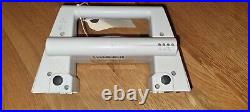
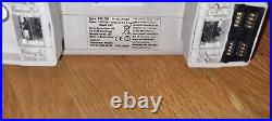
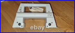
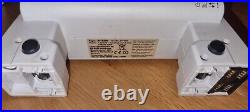
For sale we have this Leica RX1250TC controller which is in good condition and full working order. Please note the battery cover hinges are broken however the cover can be secured. Included in the sale is the controller only, no other accessories.
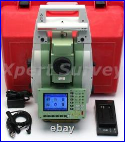
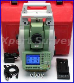
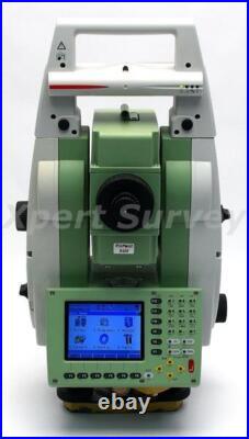
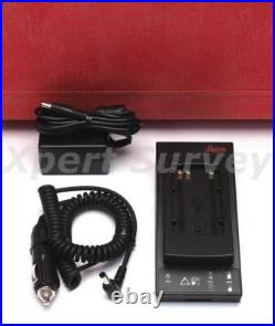
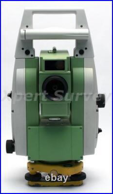
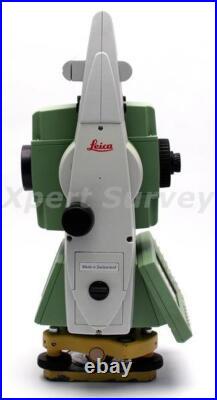
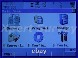
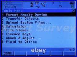
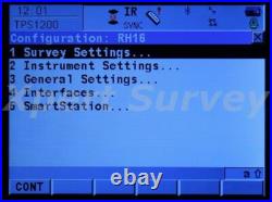
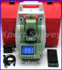
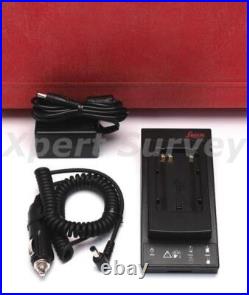
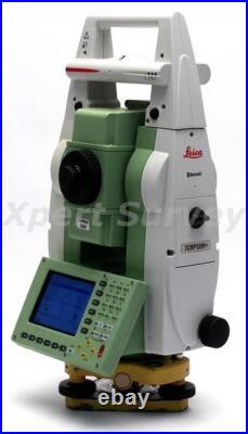
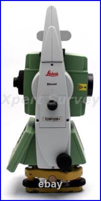
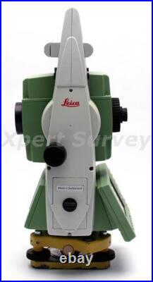
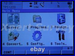
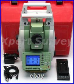
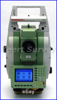
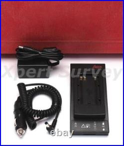
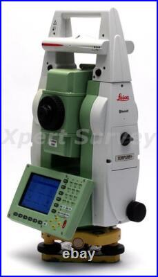
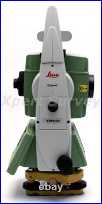
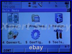
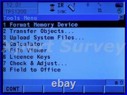
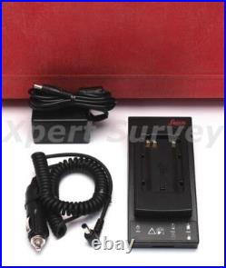
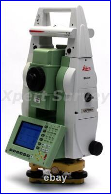
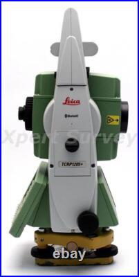
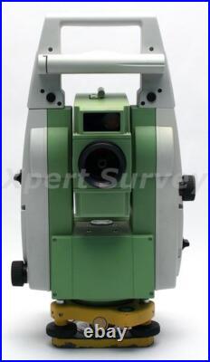
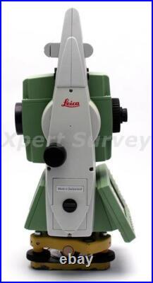
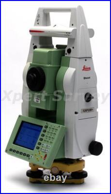
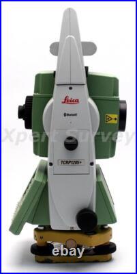
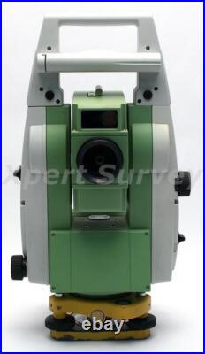
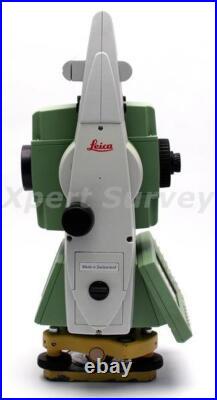
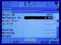
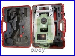
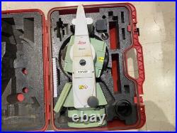
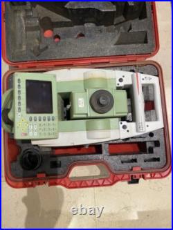
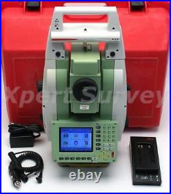
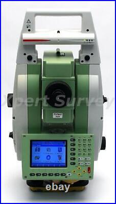
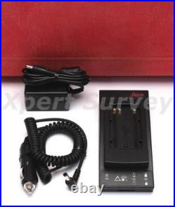
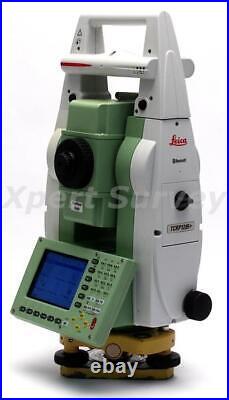
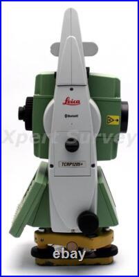
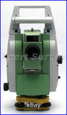
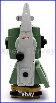
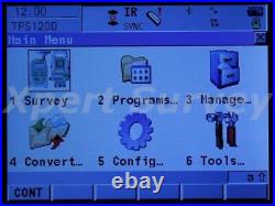
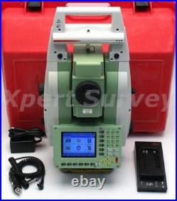
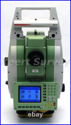
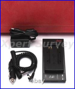
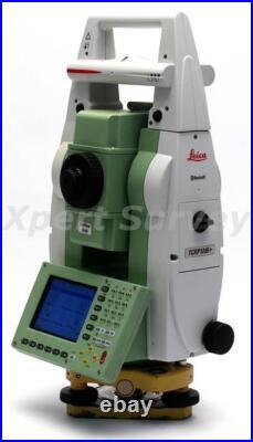
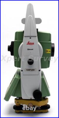
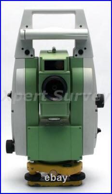
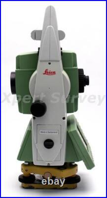
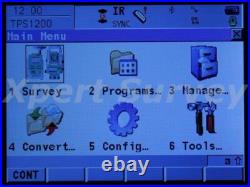
Michigan based company with a global presence. Offering New & Refurbished Total Stations, GPS / GNSS Base & Rovers, Radios, Antennas, Data Collectors, Grade & Pipe Lasers, Digital Levels, Magnetic Locators, Grade Control Systems, AgGPS Systems, Field Supplies, Accessories, Hand Tools & Safety Equipment! Leica TCRP1205+R400 5 Motorized Auto Target Total Station ID- X3386-L/T. Factory Calibrated Leica GKL211 Battery Charger Battery Pack AC Adapter/Charger DC Car Charger User Manual On CD Hard Carrying Case. Leica TCRP1205+R400 5 Motorized Auto Target Total Station – Calibrated By A Leica Service Center. Leica TRCP1205+R400 Specifications Table. Leica TRCP1205+R400 5 Motorized Auto Target Total Station. Measurements of high angles precise and accurate measurements long distance, supported for a quick and perfect systems Automatic aims at the prism. You will work faster, more rigorously and under less pressure. Intuitive interface, powerful database routines and programs loaded in total station: simplicity and identical in TPS and GPS. Easy viewing of entire surveyed area and immediate access to all measured data. You see exactly what you’ve done and what you’ve still to do. Configure and program the TPS1200 as you wish, for their applications, and export the infomation needed. TPS1200 total stations cover a range of models and options. Select the ones that suit you best. Use TPS1200 For Everything. Use TPS1200 total stations for surveying, engineering, stakeout, topo, monitoring etc. Combine them with GNSS. Benefit from huge productivity of System 1200. Find the prism automatically. PowerSearch finds reflectors within seconds no matter where they are. With PowerSearch activated, TPS1200 rotates and sends out a vertical laser fan. As soon as the fan strikes a prism TPS1200 stops rotating, ATR takes over and fine points – all fully automatically. Accuracy (standard deviation ISO 17123- 3). 5 (1.5 mgon). 0.1 (0.5 mgon). Working range: 4′ (0.07 gon) Setting accuracy: 1.5 (0.5 mgon) Method: centralized dual axis compensator. Distance measurement (IR) (Light haze, visibility about 20 km; or moderate sunlight, slight heat shimmer). 3000 m (10000 ft). 3 standard prisms (GPR1). 4500 m (14700 ft). 1500 m (5000 ft). 360° mini prism (GRZ101). 800 m (2600 ft). 1200 m (4000 ft). Reflector tape (60 mm x 60mm). 250 m (800 ft). Accuracy (standard deviation ISO 17123-4) / Measure time. Standard mode: 2 mm + 2 ppm / typ. 1.5 s Fast mode: 5 mm + 2 ppm / typ. 0.8 s Tracking mode: 5 mm + 2 ppm / typ. Principle: Phase measurement Type: Coaxial, infrared laser Carrier wave: 780 nm Measuring system: Special frequency system basis 100 MHz = 1.5 m. PinPoint reflectorless distance measurement (RL) (Object in shade, or sky overcast). 400m / 200m (Kodak Gray Card: 90% reflective / 18% / 18% reflective). Shortest / Longest measureable distanec: 1.5m / 1000m-7500m. Accuracy / Measurement Time (standard deviation, ISO 17123-4) (object in shade, sky overcast). 500m: 4mm + 2ppm / typ. 12s Long Range: 5mm + 2ppm / typ. At 30m: approx 7mm x 10mm At 50m: approx 8mm x 20mm. PinPoint R400: system analyzer (coaxial, visible red laser). Automatic Target Recognition (ATR). Range ATR / Lock Mode. Standard prism (GPR1): 1000 m (3300 ft) / 800 m (2600 ft) 360° prism (GRZ4): 600 m (2000 ft) / 500 m (1600 ft) 360° mini prism (GRZ101): 350 m (1150 ft) / 300 m (1000 ft) Mini prism (GMP101): 500 m (1600 ft) / 400 m (1300 ft) Reflector tape (60 mm x 60mm): 55 m (175ft) / – Shortest measuring distance: 1.5 m / 5 m. Accuracy / Measure time. Maximum speed (LOCK mode). Tangential (standard mode): 5 m / s at 20 m, 25 m / s at 100 m Radial (tracking mode): 5 m / s. Search time in field of view: Typ. 3 s Field of view: 1° 30′ (1.66 gon) Definable search Windows: Yes. Principle: Digital image processing Type: infrared laser. Standard prism (GPR1): 200 m (650 ft) 360° prism (GRZ4): 200 m (650 ft) (perfectly aligned to the instrument) Mini prism (GMP101): 100 m (330 ft) Shortest measuring distance: 1.5 m. Principle: Digital signal processing Type: infrared laser. Working range: 5 m – 150 m. Positioning accuracy: 5 cm at 100 m. Magnification: 30 x Free objective aperture: 40 mm Field of view: 1°30′ (1.66 gon) / 2.7 m at 100 m Focusing range: 1.7 m to infinity. Display: ¼ VGA (320240 pixels), graphic LCD, illumination, touch screen (optional) Keyboard: 34 keys (12 function keys, 12 alphanumeric keys), illumination Angle display: 360°’ , 360° decimal, 400 gon, 6400 mil, V% Distance display: meter, int. Ft/inch, US ft, US ft/inch Position: face I standard / face II optional. Internal memory: 32 MB (optional) Memory card: CompactFlash cards (32 MB and 256 MB) Number of data records: 1750 / MB Interface: RS232, BluetoothTM (optional). Centering accuracy: 1.5 mm at 1.5 m (deviation from plumb line) Laser dot diameter: 2.5 mm at 1.5 m. Number of drives: 1 horizontal / 1 vertical. Sensitivity: 6′ / 2 mm. Type: Lithium-Ion Voltage: 7.4 V Capacity: 3.8 Ah Operating time: Typ. 6 – 8 h. Tilting axis height: 196 mm above tribrach Height: 345 mm Width: 226 mm Length: 203 mm. Total station: 4.8 – 5.5 kg (depending on type and options) Battery (GEB221): 0.2 kg Tribrach (GDF121): 0.8 kg. Working temperature range: -20°C to +50°C Storage temperature range: -40°C to +70°C Dust / water (IEC 60529): IP54 Humidity: 95%, non-condensing. (Certain orders may take longer for processing due to comprehensive final service inspections). Sell Smarter with Kyozou. Inventory and Ecommerce Management.
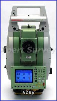
Entreprise basée au Michigan avec une présence mondiale. Nous expédions dans le monde entier à des milliers de clients satisfaits. Notre équipement bénéficie d’un service client et d’une assistance exceptionnels, ainsi que d’une garantie complète. Offrant des stations totales neuves et remises à neuf, des bases et mobiles GPS/GNSS, des radios, des antennes, des collecteurs de données, des lasers de nivellement et de canalisation, des niveaux numériques, des localisateurs magnétiques, des systèmes de contrôle de nivellement, des systèmes AgGPS, des fournitures de terrain, des accessoires, des outils manuels et des équipements de sécurité! Description de l’article. Station totale motorisée à cible automatique Leica TCRP1205+R400 5 ID- X3386-L/T. Calibré en usine Chargeur de batterie Leica GKL211 Batterie Adaptateur secteur/chargeur Chargeur de voiture CC Manuel d’utilisation sur CD Étui de transport rigide. État : Remis à neuf. Garantie : échange de 90 jours. Station totale motorisée à cible automatique Leica TCRP1205+R400 5 – Calibré par un centre de service Leica. Tableau des spécifications du Leica TRCP1205+R400. Station totale motorisée à cible automatique Leica TRCP1205+R400 5. Superbe technologie de mesure. Mesures d’angles élevés, mesures précises et précises sur longue distance, prises en charge pour un système rapide et parfait, visées automatiques sur le prisme. Vous travaillerez plus vite, plus rigoureusement et sous moins de pression. Interface intuitive, routines de base de données puissantes et programmes chargés dans la station totale : simplicité et identique en TPS et GPS. Visualisation facile de l’ensemble de la zone étudiée et accès immédiat à toutes les données mesurées. Vous voyez exactement ce que vous avez fait et ce qu’il vous reste à faire. Configurez et programmez le TPS1200 comme vous le souhaitez, pour ses applications, et exportez les informations nécessaires. Les stations totales TPS1200 couvrent une gamme de modèles et d’options. Sélectionnez ceux qui vous conviennent le mieux. Utilisez le TPS1200 pour tout. Utilisez les stations totales TPS1200 pour l’arpentage, l’ingénierie, l’implantation, la topographie, la surveillance, etc. Bénéficiez de l’énorme productivité du Système 1200. Trouver le prisme automatiquement. PowerSearch trouve les réflecteurs en quelques secondes, peu importe où ils se trouvent. Avec PowerSearch activé, le TPS1200 tourne et envoie un ventilateur laser vertical. Dès que le ventilateur heurte un prisme, le TPS1200 cesse de tourner, l’ATR prend le relais et peaufine le tout, de manière entièrement automatique. Précision (écart type ISO 17123-3). 5 (1,5 mg). Afficher le plus petit nombre. 0,1 (0,5 mggon). Plage de travail : 4′ (0,07 gon) Précision du réglage : 1,5 (0,5 mgon) Méthode : compensateur centralisé à deux axes. Mesure de distance (IR) (légère brume, visibilité d’environ 20 km ; ou ensoleillement modéré, léger reflet thermique). 3 000 m (10 000 pieds). 3 prismes standards (GPR1). 4 500 m (14 700 pieds). 1 500 m (5 000 pieds). Mini prisme 360° (GRZ101). 800 m (2 600 pieds). 1 200 m (4 000 pieds). Bande réfléchissante (60 mm x 60 mm). 250 m (800 pi). Distance de mesure la plus courte. Précision (écart type ISO 17123-4) / Temps de mesure. Mode standard : 2 mm + 2 ppm / typ. 1,5 s Mode rapide : 5 mm + 2 ppm / typ. 0,8 s Mode de suivi : 5 mm + 2 ppm / typ. Principe : Mesure de phase Type : Laser infrarouge coaxial Onde porteuse : 780 nm Système de mesure : base d’un système de fréquence spécial 100 MHz = 1,5 m. Mesure de distance sans réflecteur PinPoint (RL) (objet à l’ombre ou ciel couvert). 400 m / 200 m (Carte grise Kodak : 90 % réfléchissant / 18 % / 18 % réfléchissant). Distance mesurable la plus courte/la plus longue : 1,5 m/1 000 m-7 500 m. Précision / Temps de mesure (écart type, ISO 17123-4) (objet à l’ombre, ciel couvert). 500m : 4mm + 2ppm / typ. 12s Longue portée : 5 mm + 2 ppm / typ. 2,5 s, maximum. Taille du point laser. À 30 m : environ 7 mm x 10 mm À 50 m : environ 8 mm x 20 mm. PinPoint R400 : analyseur de système (laser rouge visible et coaxial). Reconnaissance automatique de cible (ATR). Portée ATR / Mode verrouillage. Prisme standard (GPR1) : 1 000 m (3 300 pi) / 800 m (2 600 pi) Prisme 360° (GRZ4) : 600 m (2 000 pi) / 500 m (1 600 pi) Mini prisme 360° (GRZ101) : 350 m (1 150 pi) / 300 m (1 000 pi) Mini prisme (GMP101) : 500 m (1 600 pi) / 400 m (1 300 pi) Bande réfléchissante (60 mm x 60 mm) : 55 m (175ft) / – Distance de mesure la plus courte : 1,5 m / 5 m. Précision / Temps de mesure. Précision de positionnement (GPR1). Vitesse maximale (mode LOCK). Tangentiel (mode standard) : 5 m/s à 20 m, 25 m/s à 100 m Radial (mode suivi) : 5 m/s. Temps de recherche dans le champ de vision : Typ. 3 s Champ de vision : 1° 30′ (1,66 gon) windows de recherche paramétrables : Oui. Principe : Traitement numérique des images Type : laser infrarouge. Prisme standard (GPR1) : 200 m (650 pi) Prisme 360° (GRZ4) : 200 m (650 ft) (parfaitement aligné sur l’instrument) Mini prisme (GMP101) : 100 m (330 pi) Distance de mesure la plus courte : 1,5 m. Temps de recherche : Typ. Principe : Traitement numérique du signal Type : laser infrarouge. Lumière de guidage (EGL). Portée de travail : 5 m – 150 m. Précision de positionnement : 5 cm à 100 m. Grossissement : 30x Ouverture d’objectif libre : 40 mm Champ de vision : 1°30′ (1,66 gon) / 2,7 m à 100 m Plage de mise au point : 1,7 m à l’infini. Affichage : ¼ VGA (320240 pixels), LCD graphique, éclairage, écran tactile (en option) Clavier : 34 touches (12 touches de fonction, 12 touches alphanumériques), éclairage Affichage de l’angle : 360°’ , 360° décimal, 400 gon, 6400 mil, V% Affichage de la distance : mètre, int. Pieds/pouces, pieds américains, pieds américains/pouces Position : face I standard / face II en option. Mémoire interne : 32 Mo (en option) Carte mémoire : cartes CompactFlash (32 Mo et 256 Mo) Nombre d’enregistrements de données : 1750 / Mo Interface : RS232, BluetoothTM (en option). Précision de centrage : 1,5 mm à 1,5 m (écart par rapport au fil à plomb) Diamètre du point laser : 2,5 mm à 1,5 m. Des trajets sans fin. Nombre d’entraînements : 1 horizontal / 1 vertical. Sensibilité : 6′ / 2 mm. Type : Lithium-Ion Tension : 7,4 V Capacité : 3,8 Ah Durée de fonctionnement : Typ. 6 – 8 heures. Hauteur de l’axe d’inclinaison : 196 mm au dessus de l’embase Hauteur : 345 mm Largeur : 226 mm Longueur : 203 mm. Station totale : 4,8 – 5,5 kg (selon le type et les options) Batterie (GEB221) : 0,2 kg Embase (GDF121) : 0,8 kg. Plage de température de fonctionnement : -20°C à +50°C Plage de température de stockage : -40°C à +70°C Poussière / eau (IEC 60529) : IP54 Humidité : 95 %, sans condensation. Nous tenterons d’expédier vos articles dans les 24 heures suivant la réception du paiement. Sur les articles expédiés depuis un pays étranger. Nous ne prenons pas en charge ces frais et nous vous recommandons de contacter l’agence douanière de votre pays pour obtenir ces informations. Le processus de paiement est conçu de manière à communiquer avec le commerçant pour confirmer que le paiement a été effectué et compensé. D’autres méthodes de paiement sont décrites via le processus de paiement en ligne. Les enchérisseurs gagnants doivent nous contacter dans les 3 jours suivant la clôture des enchères si des modalités de paiement spéciales sont nécessaires. Votre paiement est attendu dans les 5 jours après la clôture des enchères. Les enchères non payées seront annulées 5 jours après la clôture des enchères et le ou les articles seront remis en vente. Les articles seront expédiés dans les 24 heures (1 jour ouvrable) dès réception du paiement de l’enchérisseur gagnant. (Certaines commandes peuvent prendre plus de temps à traiter en raison d’inspections de service finales complètes). Un ou plusieurs numéros de suivi des expéditions seront fournis pour informer les acheteurs de leur ETA (heure d’arrivée estimée) prévue. Les numéros de suivi seront fournis le jour même de l’expédition de la commande. Vendez plus intelligemment avec Kyozou. Gestion des stocks et du commerce électronique. Les enchérisseurs gagnants doivent nous contacter dans les 3 jours suivant la.
Michigan based company with a global presence. Offering New & Refurbished Total Stations, GPS / GNSS Base & Rovers, Radios, Antennas, Data Collectors, Grade & Pipe Lasers, Digital Levels, Magnetic Locators, Grade Control Systems, AgGPS Systems, Field Supplies, Accessories, Hand Tools & Safety Equipment! Leica TCRP1205+R400 5 Motorized Auto Target Total Station ID- X3386-L/T. Factory Calibrated Leica GKL211 Battery Charger Battery Pack AC Adapter/Charger DC Car Charger User Manual On CD Hard Carrying Case. Leica TCRP1205+R400 5 Motorized Auto Target Total Station – Calibrated By A Leica Service Center. Leica TRCP1205+R400 Specifications Table. Leica TRCP1205+R400 5 Motorized Auto Target Total Station. Measurements of high angles precise and accurate measurements long distance, supported for a quick and perfect systems Automatic aims at the prism. You will work faster, more rigorously and under less pressure. Intuitive interface, powerful database routines and programs loaded in total station: simplicity and identical in TPS and GPS. Easy viewing of entire surveyed area and immediate access to all measured data. You see exactly what you’ve done and what you’ve still to do. Configure and program the TPS1200 as you wish, for their applications, and export the infomation needed. TPS1200 total stations cover a range of models and options. Select the ones that suit you best. Use TPS1200 For Everything. Use TPS1200 total stations for surveying, engineering, stakeout, topo, monitoring etc. Combine them with GNSS. Benefit from huge productivity of System 1200. Find the prism automatically. PowerSearch finds reflectors within seconds no matter where they are. With PowerSearch activated, TPS1200 rotates and sends out a vertical laser fan. As soon as the fan strikes a prism TPS1200 stops rotating, ATR takes over and fine points – all fully automatically. Accuracy (standard deviation ISO 17123- 3). 5 (1.5 mgon). 0.1 (0.5 mgon). Working range: 4′ (0.07 gon) Setting accuracy: 1.5 (0.5 mgon) Method: centralized dual axis compensator. Distance measurement (IR) (Light haze, visibility about 20 km; or moderate sunlight, slight heat shimmer). 3000 m (10000 ft). 3 standard prisms (GPR1). 4500 m (14700 ft). 1500 m (5000 ft). 360° mini prism (GRZ101). 800 m (2600 ft). 1200 m (4000 ft). Reflector tape (60 mm x 60mm). 250 m (800 ft). Accuracy (standard deviation ISO 17123-4) / Measure time. Standard mode: 2 mm + 2 ppm / typ. 1.5 s Fast mode: 5 mm + 2 ppm / typ. 0.8 s Tracking mode: 5 mm + 2 ppm / typ. Principle: Phase measurement Type: Coaxial, infrared laser Carrier wave: 780 nm Measuring system: Special frequency system basis 100 MHz = 1.5 m. PinPoint reflectorless distance measurement (RL) (Object in shade, or sky overcast). 400m / 200m (Kodak Gray Card: 90% reflective / 18% / 18% reflective). Shortest / Longest measureable distanec: 1.5m / 1000m-7500m. Accuracy / Measurement Time (standard deviation, ISO 17123-4) (object in shade, sky overcast). 500m: 4mm + 2ppm / typ. 12s Long Range: 5mm + 2ppm / typ. At 30m: approx 7mm x 10mm At 50m: approx 8mm x 20mm. PinPoint R400: system analyzer (coaxial, visible red laser). Automatic Target Recognition (ATR). Range ATR / Lock Mode. Standard prism (GPR1): 1000 m (3300 ft) / 800 m (2600 ft) 360° prism (GRZ4): 600 m (2000 ft) / 500 m (1600 ft) 360° mini prism (GRZ101): 350 m (1150 ft) / 300 m (1000 ft) Mini prism (GMP101): 500 m (1600 ft) / 400 m (1300 ft) Reflector tape (60 mm x 60mm): 55 m (175ft) / – Shortest measuring distance: 1.5 m / 5 m. Accuracy / Measure time. Maximum speed (LOCK mode). Tangential (standard mode): 5 m / s at 20 m, 25 m / s at 100 m Radial (tracking mode): 5 m / s. Search time in field of view: Typ. 3 s Field of view: 1° 30′ (1.66 gon) Definable search windows: Yes. Principle: Digital image processing Type: infrared laser. Standard prism (GPR1): 200 m (650 ft) 360° prism (GRZ4): 200 m (650 ft) (perfectly aligned to the instrument) Mini prism (GMP101): 100 m (330 ft) Shortest measuring distance: 1.5 m. Principle: Digital signal processing Type: infrared laser. Working range: 5 m – 150 m. Positioning accuracy: 5 cm at 100 m. Magnification: 30 x Free objective aperture: 40 mm Field of view: 1°30′ (1.66 gon) / 2.7 m at 100 m Focusing range: 1.7 m to infinity. Display: ¼ VGA (320240 pixels), graphic LCD, illumination, touch screen (optional) Keyboard: 34 keys (12 function keys, 12 alphanumeric keys), illumination Angle display: 360°’ , 360° decimal, 400 gon, 6400 mil, V% Distance display: meter, int. Ft/inch, US ft, US ft/inch Position: face I standard / face II optional. Internal memory: 32 MB (optional) Memory card: CompactFlash cards (32 MB and 256 MB) Number of data records: 1750 / MB Interface: RS232, BluetoothTM (optional). Centering accuracy: 1.5 mm at 1.5 m (deviation from plumb line) Laser dot diameter: 2.5 mm at 1.5 m. Number of drives: 1 horizontal / 1 vertical. Sensitivity: 6′ / 2 mm. Type: Lithium-Ion Voltage: 7.4 V Capacity: 3.8 Ah Operating time: Typ. 6 – 8 h. Tilting axis height: 196 mm above tribrach Height: 345 mm Width: 226 mm Length: 203 mm. Total station: 4.8 – 5.5 kg (depending on type and options) Battery (GEB221): 0.2 kg Tribrach (GDF121): 0.8 kg. Working temperature range: -20°C to +50°C Storage temperature range: -40°C to +70°C Dust / water (IEC 60529): IP54 Humidity: 95%, non-condensing. (Certain orders may take longer for processing due to comprehensive final service inspections). Sell Smarter with Kyozou. Inventory and Ecommerce Management. This item is in the category “Business & Industrial\Test, Measurement & Inspection\Levels & Surveying Equipment\Total Stations & Accessories”. The seller is “gps_land_survey_and_mapping_equipment” and is located in this country: US. This item can be shipped worldwide.
- Brand: Leica
- MPN: TCRP1205+R400
- Model: TCRP1205+R400
Leica GPS GNSS set for leica TCRP total station. This item is in full working order and good condition. All as per photos. This item is in the category “Business, Office & Industrial\Test, Measurement & Inspection\Levels & Surveying Equipment\Other Surveying Equipment”. The seller is “golab5″ and is located in this country: GB. This item can be shipped to United Kingdom, Austria, Belgium, Bulgaria, Republic of Croatia, Cyprus, Czech Republic, Denmark, Estonia, Finland, France, Germany, Greece, Hungary, Ireland, Italy, Lithuania, Luxembourg, Malta, Netherlands, Poland, Portugal, Slovakia, Spain, Sweden, Australia, United States, Bahrain, Canada, Japan, New Zealand, Israel, Norway, Indonesia, Malaysia, Singapore, South Korea, Switzerland, Taiwan, Bangladesh, Bermuda, Bolivia, Barbados, Brunei Darussalam, Cayman Islands, Egypt, Guernsey, Gibraltar, Guadeloupe, French Guiana, Iceland, Jersey, Jordan, Cambodia, Liechtenstein, Sri Lanka, Macau, Monaco, Maldives, Martinique, Nicaragua, Oman, Pakistan, Paraguay, Reunion, Saudi Arabia, South Africa, United Arab Emirates, Bahamas, Colombia, Jamaica, Panama, Philippines, Qatar.
- Non-Domestic Product: No
- Brand: Leica
- Custom Bundle: No
- Modified Item: No
Michigan based company with a global presence. Offering New & Refurbished Total Stations, GPS / GNSS Base & Rovers, Radios, Antennas, Data Collectors, Grade & Pipe Lasers, Digital Levels, Magnetic Locators, Grade Control Systems, AgGPS Systems, Field Supplies, Accessories, Hand Tools & Safety Equipment! Leica TCRP1205+R400 5 Motorized Auto Target Total Station ID- X3386-L/T. Factory Calibrated Leica GKL211 Battery Charger Battery Pack AC Adapter/Charger DC Car Charger User Manual On CD Hard Carrying Case. Leica TCRP1205+R400 5 Motorized Auto Target Total Station – Calibrated By A Leica Service Center. Leica TRCP1205+R400 Specifications Table. Leica TRCP1205+R400 5 Motorized Auto Target Total Station. Measurements of high angles precise and accurate measurements long distance, supported for a quick and perfect systems Automatic aims at the prism. You will work faster, more rigorously and under less pressure. Intuitive interface, powerful database routines and programs loaded in total station: simplicity and identical in TPS and GPS. Easy viewing of entire surveyed area and immediate access to all measured data. You see exactly what you’ve done and what you’ve still to do. Configure and program the TPS1200 as you wish, for their applications, and export the infomation needed. TPS1200 total stations cover a range of models and options. Select the ones that suit you best. Use TPS1200 For Everything. Use TPS1200 total stations for surveying, engineering, stakeout, topo, monitoring etc. Combine them with GNSS. Benefit from huge productivity of System 1200. Find the prism automatically. PowerSearch finds reflectors within seconds no matter where they are. With PowerSearch activated, TPS1200 rotates and sends out a vertical laser fan. As soon as the fan strikes a prism TPS1200 stops rotating, ATR takes over and fine points – all fully automatically. Accuracy (standard deviation ISO 17123- 3). 5 (1.5 mgon). 0.1 (0.5 mgon). Working range: 4′ (0.07 gon) Setting accuracy: 1.5 (0.5 mgon) Method: centralized dual axis compensator. Distance measurement (IR) (Light haze, visibility about 20 km; or moderate sunlight, slight heat shimmer). 3000 m (10000 ft). 3 standard prisms (GPR1). 4500 m (14700 ft). 1500 m (5000 ft). 360° mini prism (GRZ101). 800 m (2600 ft). 1200 m (4000 ft). Reflector tape (60 mm x 60mm). 250 m (800 ft). Accuracy (standard deviation ISO 17123-4) / Measure time. Standard mode: 2 mm + 2 ppm / typ. 1.5 s Fast mode: 5 mm + 2 ppm / typ. 0.8 s Tracking mode: 5 mm + 2 ppm / typ. Principle: Phase measurement Type: Coaxial, infrared laser Carrier wave: 780 nm Measuring system: Special frequency system basis 100 MHz = 1.5 m. PinPoint reflectorless distance measurement (RL) (Object in shade, or sky overcast). 400m / 200m (Kodak Gray Card: 90% reflective / 18% / 18% reflective). Shortest / Longest measureable distanec: 1.5m / 1000m-7500m. Accuracy / Measurement Time (standard deviation, ISO 17123-4) (object in shade, sky overcast). 500m: 4mm + 2ppm / typ. 12s Long Range: 5mm + 2ppm / typ. At 30m: approx 7mm x 10mm At 50m: approx 8mm x 20mm. PinPoint R400: system analyzer (coaxial, visible red laser). Automatic Target Recognition (ATR). Range ATR / Lock Mode. Standard prism (GPR1): 1000 m (3300 ft) / 800 m (2600 ft) 360° prism (GRZ4): 600 m (2000 ft) / 500 m (1600 ft) 360° mini prism (GRZ101): 350 m (1150 ft) / 300 m (1000 ft) Mini prism (GMP101): 500 m (1600 ft) / 400 m (1300 ft) Reflector tape (60 mm x 60mm): 55 m (175ft) / – Shortest measuring distance: 1.5 m / 5 m. Accuracy / Measure time. Maximum speed (LOCK mode). Tangential (standard mode): 5 m / s at 20 m, 25 m / s at 100 m Radial (tracking mode): 5 m / s. Search time in field of view: Typ. 3 s Field of view: 1° 30′ (1.66 gon) Definable search windows: Yes. Principle: Digital image processing Type: infrared laser. Standard prism (GPR1): 200 m (650 ft) 360° prism (GRZ4): 200 m (650 ft) (perfectly aligned to the instrument) Mini prism (GMP101): 100 m (330 ft) Shortest measuring distance: 1.5 m. Principle: Digital signal processing Type: infrared laser. Working range: 5 m – 150 m. Positioning accuracy: 5 cm at 100 m. Magnification: 30 x Free objective aperture: 40 mm Field of view: 1°30′ (1.66 gon) / 2.7 m at 100 m Focusing range: 1.7 m to infinity. Display: ¼ VGA (320240 pixels), graphic LCD, illumination, touch screen (optional) Keyboard: 34 keys (12 function keys, 12 alphanumeric keys), illumination Angle display: 360°’ , 360° decimal, 400 gon, 6400 mil, V% Distance display: meter, int. Ft/inch, US ft, US ft/inch Position: face I standard / face II optional. Internal memory: 32 MB (optional) Memory card: CompactFlash cards (32 MB and 256 MB) Number of data records: 1750 / MB Interface: RS232, BluetoothTM (optional). Centering accuracy: 1.5 mm at 1.5 m (deviation from plumb line) Laser dot diameter: 2.5 mm at 1.5 m. Number of drives: 1 horizontal / 1 vertical. Sensitivity: 6′ / 2 mm. Type: Lithium-Ion Voltage: 7.4 V Capacity: 3.8 Ah Operating time: Typ. 6 – 8 h. Tilting axis height: 196 mm above tribrach Height: 345 mm Width: 226 mm Length: 203 mm. Total station: 4.8 – 5.5 kg (depending on type and options) Battery (GEB221): 0.2 kg Tribrach (GDF121): 0.8 kg. Working temperature range: -20°C to +50°C Storage temperature range: -40°C to +70°C Dust / water (IEC 60529): IP54 Humidity: 95%, non-condensing. (Certain orders may take longer for processing due to comprehensive final service inspections). Sell Smarter with Kyozou. Inventory and Ecommerce Management. This item is in the category “Business & Industrial\Test, Measurement & Inspection\Levels & Surveying Equipment\Total Stations & Accessories”. The seller is “gps_land_survey_and_mapping_equipment” and is located in this country: US. This item can be shipped worldwide.
- Brand: Leica
- MPN: TCRP1205+R400
- Model: TCRP1205+R400
LEICA TCRP 1203 R300 Robotic Total Station package, in excellent condition, 3 second high precision accuracy. Complete package, robot with batteries, Backup Battery & chargers. New Long range bluetooth Parani dongle, ready to survey, use your data logger such as Topcon or Surveyor 2 (up to 1000 feet from robot) , or Carlson tablet (1000ft from robot). Carlson Surveyor+ (up to approx 350 feet). To run this machine. Any data logger with USB output can be used to run up to 2000 feet with parani dongle. This eliminates the need for a longrange bluetooth handle. Data loggers available on request, Powersearch makes using this machine a pleasure, finding your prism quickly and holding lock easily. 360 degree prism and pole available on request. Instrument is calibrated before supplying. Leica Total Station Features. Angle display resolution: 1. IR EDM range: 3,000 m to single prism. IR Distance accuracy: 2 mm + 2 ppm. Reflectorless EDM range: 300 m (18% reflectivity); 500 m (90% reflectivity). Reflectorless EDM accuracy: 3 mm + 2 ppm. Internal Memory: 10,000 points. Removable Compact Flash Card Slot. RS232 port communicates with most data collectors. Available in multiple languages (please specify). PowerSearch prism tracking speed: 45° / s. Two large Alphanumeric keyboards with perfectly readable, high-contrast monochrome ¼ VGA LCD display. Fully robotic PowerSearch finds standard prisms within seconds at any location. Automatic Target Recognition (ATR) snaps to the center of the prism when pointed in general vicinity of prism. As in photographs, comes with all you need, Leica Robot with 1 new battery, charger, new Parani longrange bluetooth dongle and backup battery. Comes with calibration certificate. In excellent condition, calibrated and serviced ready for field use. The item “LEICA TCRP 1203 R300 Robotic Total Station kit with Parani BT Dongle” is in sale since Friday, November 26, 2021. This item is in the category “Business & Industrial\Test, Measurement & Inspection\Levels & Surveying Equipment\Total Stations & Accessories”. The seller is “allenbuildinstruments” and is located in Wake Forest, North Carolina. This item can be shipped to United States, Canada.
- Model: TCRP1200
- Country/Region of Manufacture: Switzerland
- Product: Robotic Total Station
- Bundle Listing: No
- MPN: Does Not Apply
- Brand: Leica
Michigan based company with a global presence. Offering New & Refurbished Total Stations, GPS / GNSS Base & Rovers, Radios, Antennas, Data Collectors, Grade & Pipe Lasers, Digital Levels, Magnetic Locators, Grade Control Systems, AgGPS Systems, Field Supplies, Accessories, Hand Tools & Safety Equipment! Leica TCRP1205+R400 5 Motorized Auto Target Total Station [ID- X3386] – Factory Calibrated Leica GKL211 Battery Charger Battery Pack AC Adapter/Charger DC Car Charger User Manual On CD Hard Carrying Case. Leica TCRP1205+R400 5 Motorized Auto Target Total Station – Calibrated By A Leica Service Center. Leica TRCP1205+R400 Specifications Table. Leica TRCP1205+R400 5 Motorized Auto Target Total Station. Measurements of high angles precise and accurate measurements long distance, supported for a quick and perfect systems Automatic aims at the prism. You will work faster, more rigorously and under less pressure. Intuitive interface, powerful database routines and programs loaded in total station: simplicity and identical in TPS and GPS. Easy viewing of entire surveyed area and immediate access to all measured data. You see exactly what youve done and what youve still to do. Configure and program the TPS1200 as you wish, for their applications, and export the infomation needed. TPS1200 total stations cover a range of models and options. Select the ones that suit you best. Use TPS1200 For Everything. Use TPS1200 total stations for surveying, engineering, stakeout, topo, monitoring etc. Combine them with GNSS. Benefit from huge productivity of System 1200. Find the prism automatically. PowerSearch finds reflectors within seconds no matter where they are. With PowerSearch activated, TPS1200 rotates and sends out a vertical laser fan. As soon as the fan strikes a prism TPS1200 stops rotating, ATR takes over and fine points all fully automatically. Accuracy (standard deviation ISO 17123- 3). 5 (1.5 mgon). 0.1 (0.5 mgon). Working range: 4 (0.07 gon) Setting accuracy: 1.5 (0.5 mgon) Method: centralized dual axis compensator. Distance measurement (IR) (Light haze, visibility about 20 km; or moderate sunlight, slight heat shimmer). 3000 m (10000 ft). 3 standard prisms (GPR1). 4500 m (14700 ft). 1500 m (5000 ft). 360° mini prism (GRZ101). 800 m (2600 ft). 1200 m (4000 ft). Reflector tape (60 mm x 60mm). 250 m (800 ft). Accuracy (standard deviation ISO 17123-4) / Measure time. Standard mode: 2 mm + 2 ppm / typ. 1.5 s Fast mode: 5 mm + 2 ppm / typ. 0.8 s Tracking mode: 5 mm + 2 ppm / typ. Principle: Phase measurement Type: Coaxial, infrared laser Carrier wave: 780 nm Measuring system: Special frequency system basis 100 MHz = 1.5 m. PinPoint reflectorless distance measurement (RL) (Object in shade, or sky overcast). 400m / 200m (Kodak Gray Card: 90% reflective / 18% / 18% reflective). Shortest / Longest measureable distanec: 1.5m / 1000m-7500m. Accuracy / Measurement Time (standard deviation, ISO 17123-4) (object in shade, sky overcast). 500m: 4mm + 2ppm / typ. 12s Long Range: 5mm + 2ppm / typ. At 30m: approx 7mm x 10mm At 50m: approx 8mm x 20mm. PinPoint R400: system analyzer (coaxial, visible red laser). Automatic Target Recognition (ATR). Range ATR / Lock Mode. Standard prism (GPR1): 1000 m (3300 ft) / 800 m (2600 ft) 360° prism (GRZ4): 600 m (2000 ft) / 500 m (1600 ft) 360° mini prism (GRZ101): 350 m (1150 ft) / 300 m (1000 ft) Mini prism (GMP101): 500 m (1600 ft) / 400 m (1300 ft) Reflector tape (60 mm x 60mm): 55 m (175ft) / – Shortest measuring distance: 1.5 m / 5 m. Accuracy / Measure time. Maximum speed (LOCK mode). Tangential (standard mode): 5 m / s at 20 m, 25 m / s at 100 m Radial (tracking mode): 5 m / s. Search time in field of view: Typ. 3 s Field of view: 1° 30 (1.66 gon) Definable search windows: Yes. Principle: Digital image processing Type: infrared laser. Standard prism (GPR1): 200 m (650 ft) 360° prism (GRZ4): 200 m (650 ft) (perfectly aligned to the instrument) Mini prism (GMP101): 100 m (330 ft) Shortest measuring distance: 1.5 m. Principle: Digital signal processing Type: infrared laser. Working range: 5 m – 150 m. Positioning accuracy: 5 cm at 100 m. Magnification: 30 x Free objective aperture: 40 mm Field of view: 1°30 (1.66 gon) / 2.7 m at 100 m Focusing range: 1.7 m to infinity. Display: ¼ VGA (320240 pixels), graphic LCD, illumination, touch screen (optional) Keyboard: 34 keys (12 function keys, 12 alphanumeric keys), illumination Angle display: 360° , 360° decimal, 400 gon, 6400 mil, V% Distance display: meter, int. Ft/inch, US ft, US ft/inch Position: face I standard / face II optional. Internal memory: 32 MB (optional) Memory card: CompactFlash cards (32 MB and 256 MB) Number of data records: 1750 / MB Interface: RS232, BluetoothTM (optional). Centering accuracy: 1.5 mm at 1.5 m (deviation from plumb line) Laser dot diameter: 2.5 mm at 1.5 m. Number of drives: 1 horizontal / 1 vertical. Sensitivity: 6 / 2 mm. Type: Lithium-Ion Voltage: 7.4 V Capacity: 3.8 Ah Operating time: Typ. 6 – 8 h. Tilting axis height: 196 mm above tribrach Height: 345 mm Width: 226 mm Length: 203 mm. Total station: 4.8 – 5.5 kg (depending on type and options) Battery (GEB221): 0.2 kg Tribrach (GDF121): 0.8 kg. Working temperature range: -20°C to +50°C Storage temperature range: -40°C to +70°C Dust / water (IEC 60529): IP54 Humidity: 95%, non-condensing. (Certain orders may take longer for processing due to comprehensive final service inspections). Sell Smarter with Kyozou. Inventory and Ecommerce Management. The item “Leica TCRP1205+R400 5 Motorized Auto Target Total Station TCRP 1205 + R400″ is in sale since Tuesday, August 24, 2021. This item is in the category “Business & Industrial\Test, Measurement & Inspection\Levels & Surveying Equipment\Total Stations & Accessories”. The seller is “gps_land_survey_and_mapping_equipment” and is located in Southgate, Michigan. This item can be shipped worldwide.
- Brand: Leica
- MPN: TCRP1205+R400
- Model: TCRP1205+R400